The air was cold, a few degrees above freezing. Three of us pushed one long canoe away from shore and paddled out of a swirling eddy into the main stream, thus surviving the most dangerous phase of the trip: the launch into a swift current.
We’d dressed in layers over wetsuits. But the bone-chilling cold reminded us that our canoe was balanced atop a giant swift-moving stream of hypothermia. We paddled away from the Columbia Bottoms access point into the middle of the river. Here, the Missouri is easily half a mile wide, pouring its entire collection of western waters toward the end of its 2,315-mile journey, and the end was almost in sight, a few miles downriver where it greets the Mighty Mississippi.
This meeting of the continent’s two great rivers is a sacred spot, a giver of life for the billions of birds that follow the flyways and for the fish that don’t know the names of these rivers but know the rivers’ distinctly different personalities.
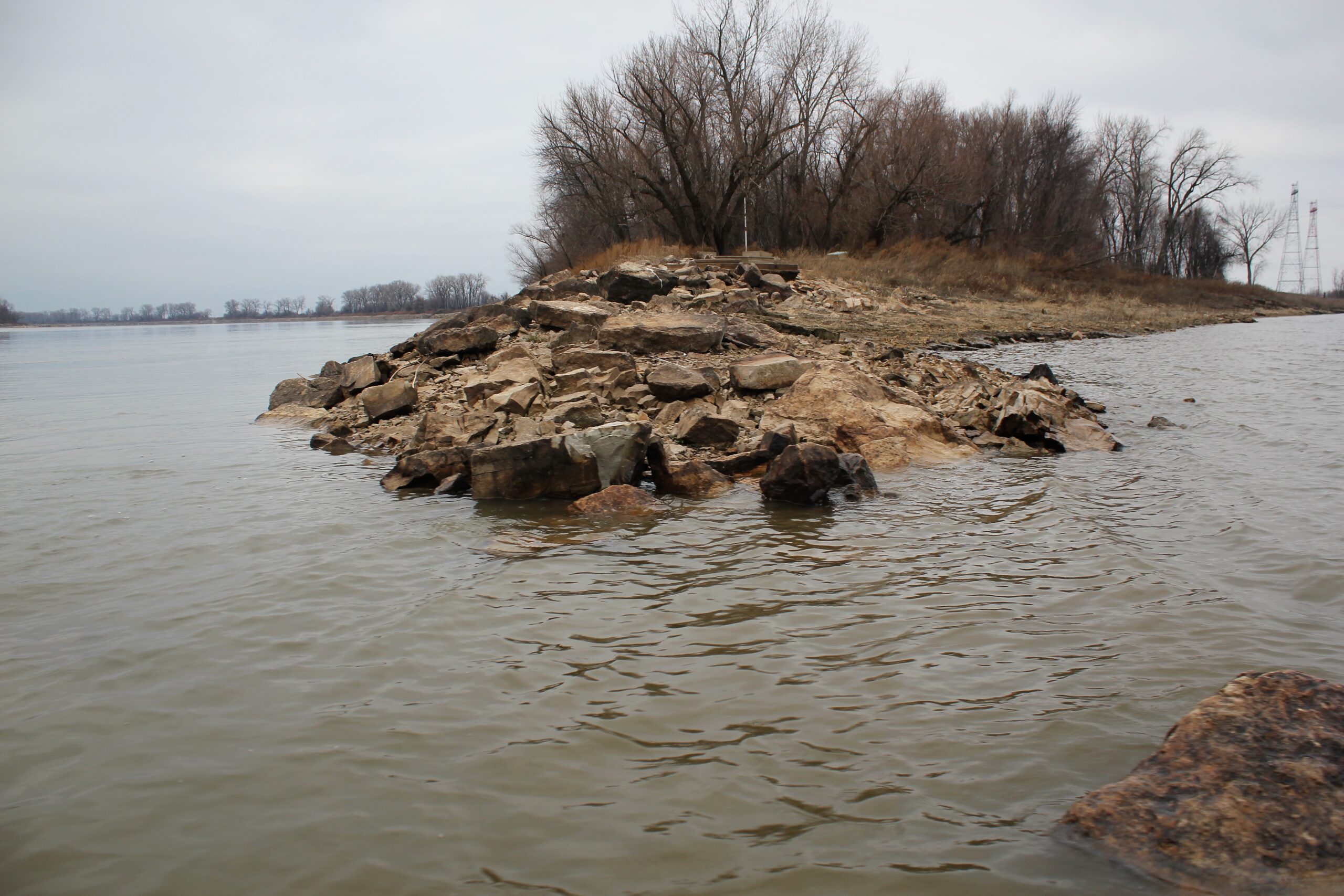
A north wind tried to aggravate us, but Cora blocked its best gusts. Cora, the island on our port side, shielded us from the wind until we were almost to the confluence of these two mighty rivers.
“Portage des Sioux is up there,” Mike pointed upriver to the spot where Native Americans used to carry their canoes across the narrowest strip of this peninsula, from one great river to the other. By portaging their gear overland, they saved a twenty-five-mile paddle around the point. It was also the site of the Treaties of Portage des Sioux, which hastened the displacement of the Mississippi tribal cultures as a hungry Manifest Destiny moved west.
But the spirits that guided the native inhabitants, they’re still here. The plants. The wildlife. The moon. And the point where two sacred rivers join together.
You can feel it, the life-giving power of these waters. Indeed, there’s only one reason St. Louis grew so populous. The confluence.
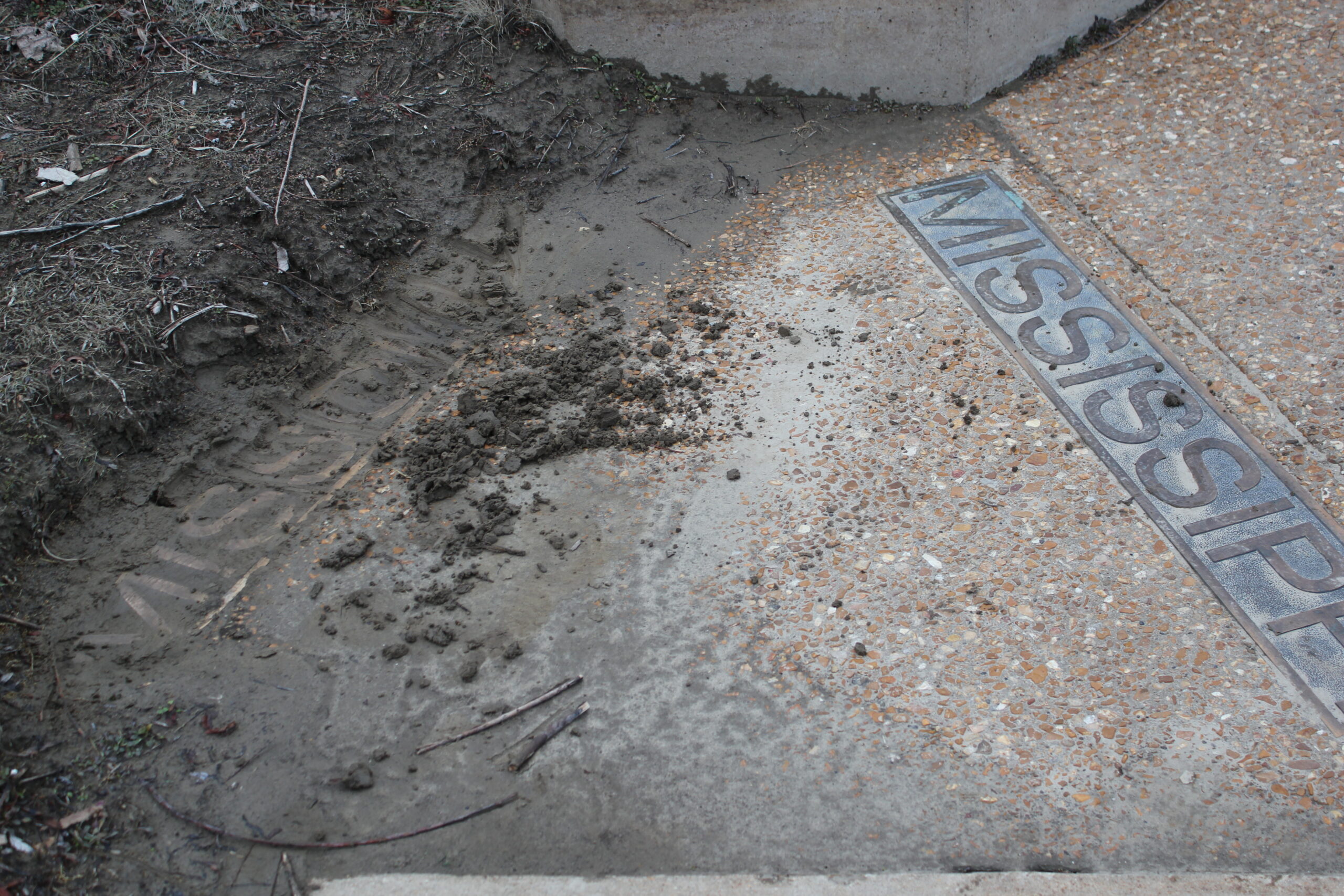
We paddled to the point, where I stood with one foot in the Missouri, the other in the Mississippi. Facing that narrow backbone of land that finally allows these rivers to mingle around my ankles, I saw two bronze nameplates, one embedded in each bank. The north plate spells Mississippi River. Just a few feet away, the south plate is covered in mud. As I scraped the mud off the letters that spell Missouri River, it was living proof that Big Muddy delivers on its reputation. You could grow cotton on top of that nameplate.
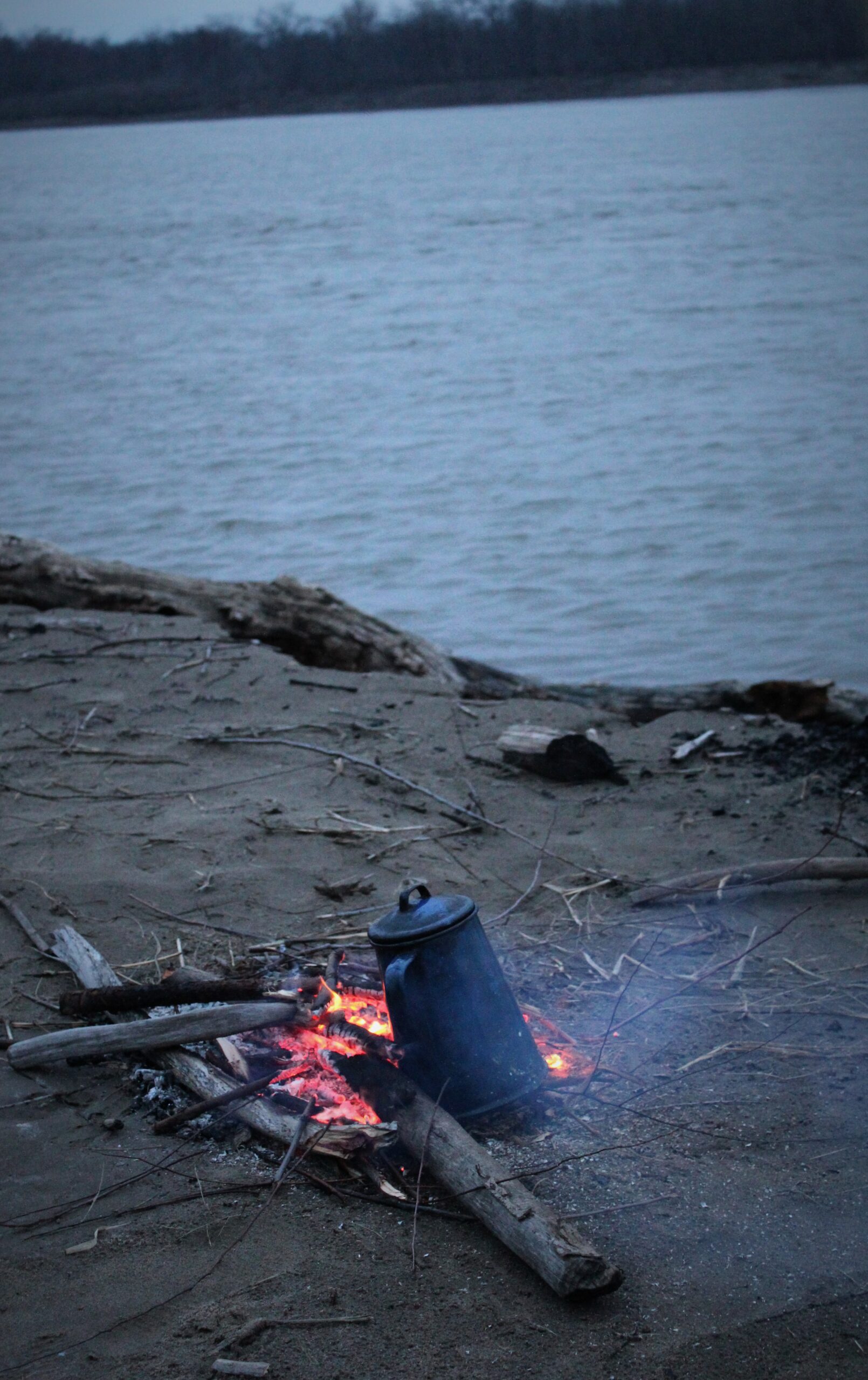
The sun set as we paddled down the Mississippi. We stopped on a sand bar and built a fire, boiled some water and drank hot tea. Then we drowned the fire and in the winter darkness, climbed in our canoe. We were fearless as we paddled down the Mississippi, black water against black forest, silhouetted in the dim backlight of a major urban center, just over the hills out of sight. The moon rose to guide us to our landing.
Sacred.
–from Coastal Missouri, by J.D. Robinson
Share this Post
One Comment on “Winter Water”
I’ve heard that if named now, better mapping, that it would all be the Missouri River down to the Gulf. May I ask your prospective on that?